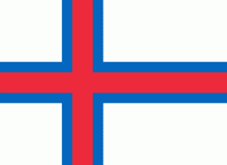
Sørvágur
* There is also a town called Vágur on Suðuroy.
Sørvágur (Sørvåg) is a village on the island of Vágar in the Faroe Islands.
It is located at the landward end of Sørvágsfjørður. Sørvágur is the largest village in Sørvágur Municipality.
The name Sørvágur translates to "The Bay of Sør". While the second half of the name makes sense given the fact that the village is located at a bay, the first half is more mysterious. Legend has it that the first man to settle at this place was called 'Sørli' and hence the village was named in honour of him. Another explanation on the origin of 'Sør' comes from the old-Norse 'Seyr' which is a word for sand (seyr is also a word for foggy rain). Sørvágur has quite a large sandbeach in comparison with other Faroese villages and towns, and therefore it was speculated that the original name of Sørvágur was Seyrvágur, and during the course of time, Seyrvágur became Sørvágur. During the first half of the 20th century local people in Sørvágur tried to correct this historical injustice and used the name Seyrvágur instead of Sørvágur. However, this trend died out again. One reason may be that there is no proof in the Faroese historical records that justifies the name Seyrvágur.
As of today (2005) nobody has come up with at reasonable explanation to the origin of the name Sørvágur.
Map - Sørvágur
Map
Country - Faroe_Island
 |
 |
They are located 200 mi north-northwest of the United Kingdom, and about halfway between Norway (360 mi away) and Iceland (270 mi away). The islands form part of the Kingdom of Denmark, along with mainland Denmark and Greenland. The islands have a total area of about 540 sqmi with a population of 54,000 as of June 2022.
Currency / Language
| ISO | Currency | Symbol | Significant figures |
|---|---|---|---|
| DKK | Danish krone | kr | 2 |
| ISO | Language |
|---|---|
| DA | Danish language |
| FO | Faroese language |


